|
Research |
--- |
|
|
|
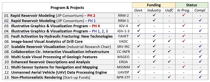
Hyperlinked Table (Completed Projects, i.e, no. 02, 04, 07, 08, 09, 10, 12, 13)
|
|
|
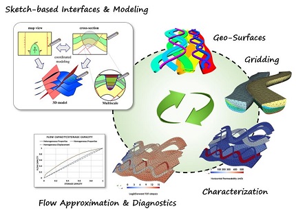
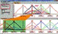
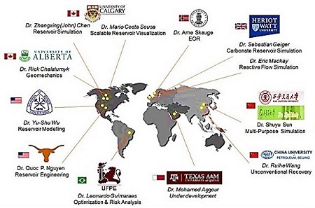
02. |
---- Joint
industry project (JIP), PHASE 1
(completed), PHASE
2 (in
progress).
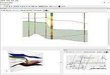
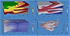
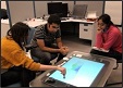
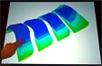
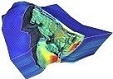
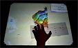
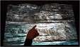
A multi-disciplinary (i.e.,
Computer Science, Geoscience, and
Petroleum Engineering) research
and development of a Rapid
Reservoir Modeling (RRM) software
framework for prototyping complex
conceptual reservoir models,
using novel, sketch-based
interface and modeling (SBIM)
algorithms and methods,
exploratory visualization &
visual analytics, and numerical
modeling and analysis of
fundamental reservoir properties
and behaviors.
1. Dr.
Mario Costa Sousa
(Co-PI) University
of Calgary, Computer Science
(CAN) 2. Dr.
Sebastian Geiger
(Co-PI) Heriot-Watt
University, Energy, Geoscience,
Infrastructure and Society (GBR)
now at 3. Dr.
Matthew Jackson
(Co-PI) Imperial
College London, Earth Science
& Engineering
(GBR) |
||||||||||||||||||||||
|
|
|
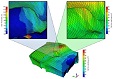
Illustrative
visualization framework and toolset
incorporates traditional
Scientific-Technical-Medical (STM)
illustration principles, practices, and
methods with existing and forthcoming
graphics and visualization systems and
techniques. PHASES 1, 2, and 3 of this
program focused on fundamental components
of our framework, including: PHASE
4
(in progress)
is
focusing on context-awereness aspects of
our illustrative graphics and
visualization framewor. |
|||||||||||||||||||||
|
|
|
|
|||||||||||||||||||||
|
|
|
||||||||||||||||||||||
|
|
|
|
|||||||||||||||||||||
|
|
   |
ENHANCED
USE OF NUMERICAL METHODS FOR ENHANCED
TECHNIQUES FOR HISTORY MATCHING AND
FORECASTING |
|||||||||||||||||||||
|
|
|
Research
and development of a web-based platform
for flexible and accessible UAV-based data
processing while tackling the posed
challenges by using consumer-grade sensors
and diversity of potential system
users/applications. The research outcome
will be a light, streamlined application
capable of accurate mapping and monitoring
that can be affordably/conveniently
accessed and used by data providers and
end-users. These users might not have a
high level of technical mapping expertise
in various applications. |
|||||||||||||||||||||
|
|
|
|
|||||||||||||||||||||
 --
--
 --
--
 --
--

 Jackson
et al. 2013
Jackson
et al. 2013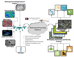
 -
-